Focus Areas
Globally, climate-related variabilities and competing demands for water are significantly stressing water resources
Globally, climate-related variabilities and competing demands for water are significantly stressing water resources. From an evolving megadrought in the southwestern United States, to chronically overburdened water systems in sub-Saharan Africa, to more severe storms and flooding in coastal zones, water resource management challenges are a global issue. Decision-makers and communities must increasingly rely on innovative tools and technologies to help them adapt to these changes more effectively.
What is water resources management?
Water Resources Management is the holistic approach to managing water supply and water risks to ensure sufficient quantity and quality to meet many competing demands, including drinking water and sanitation as well as energy production, food production, water transportation and navigation, recreation, and maintaining sustainable ecosystems and natural beauty. This includes planning, forecasting, and identifying the most effective and environmentally conscious methods of managing resources and maintaining cost-effective access to water.
The engineers and scientists at RTI are experts in all aspects of water resources management—from the analysis of weather and climate inputs, to modeling all parts of the hydrologic cycle, to the visualization and dissemination of model outputs and policy consequences. Our models, systems, and analyses provide the information water managers need to make decisions that support the safe, reliable, and sustainable use of water.
Our expertise focuses on modeling and systems development, including hydrologic, hydraulic, water quality, and reservoir modeling; the economic analysis of water management decisions; the evaluation of climate impacts; and the valuation of ecosystem services.
Taking a systems approach to water management
RTI’s systems approach to water management seeks to provide actionable information to stakeholders at all levels. This includes locally tailored data management solutions based on user needs, the integration of a variety of specialized models and tools, and delivery of customized products that can inform decisions. The result of many of our projects is a system that provides detailed, pertinent, and timely information as close to the user’s decision point as possible. The systems can also present results and consequences of the management decision.
CWR’s expertise in water resources modeling and analyses is focused in three primary areas:
- Water resources forecasting
- Water supply modeling
- Hydrologic risk
In water resources forecasting, we use weather inputs to predict river flows and water levels. These forecasts provide water managers with the information necessary to manage, in real-time, reservoir releases, hydropower generation, water allocations, and flood warnings. RTI-implemented forecast systems are in place throughout the U.S. and around the world in diverse locations such as New York City, the Tennessee Valley Authority, and for the Panama Canal.
In water supply modeling, we deliver comprehensive watershed modeling capabilities accounting for reservoirs, diversions, agriculture, municipal use, groundwater interaction, etc., to determine water availability and to identify how changes within the basin will affect hydrology. For example, we identify the hydrologic and economic impacts of converting farmland to an urban environment, and how downstream water users would be affected by changed release operations at a dam. In Honduras, we used RTI’s WaterALLOC modeling system to identify the hydrologic and economic impacts of changing water demands in Tegucigalpa and of potential new water supply infrastructure.
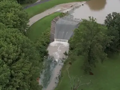
For hydrologic risk projects, we run hydrologic and hydraulic models under severe conditions including dam breaks, extreme weather events, and a changing environment. Our model results are used by cities and local and national governments to identify risks and potential economic consequences, allowing them to be better prepared and to better allocate investments based on science-informed results. RTI applied our Rapid Risk Analysis Tool for more than 100 dams throughout India to quantify hydrologic hazards, which allowed the World Bank and the Government of India to evaluate the economic benefits and impacts of proposed dam risk safety improvement projects.
Meet the Experts
View All Experts
Navigate to
Nicole Novembre, PE

Nicole Novembre, PE
Navigate to
Florian Kluibenschädl

Florian Kluibenschädl
Navigate to
Matthew Denno

Matthew Denno
Navigate to
Ryan Johnson

Ryan Johnson
Navigate to
Jonathan McIntosh

Jonathan McIntosh
Navigate to
Jeremy Carlston

Jeremy Carlston
Navigate to
John Park

John Park
Navigate to
Michael Crouch

Michael Crouch
Navigate to
Enrique Triana

Enrique Triana
Navigate to
Shaun Carney

Shaun Carney
Navigate to
Ted Lillys

Ted Lillys
Navigate to
Juliana Corrales

Juliana Corrales
Navigate to
George L. Van Houtven

George L. Van Houtven
Related Projects
Identifying Optimal Paths for Dam Improvement with New Brunswick Power
Comprehensive Analysis Shows the Benefits of Assessing Dam Risk
Read More about Identifying Optimal Paths for Dam Improvement with New Brunswick Power