Solutions
Understanding flood impacts to protect downstream communities
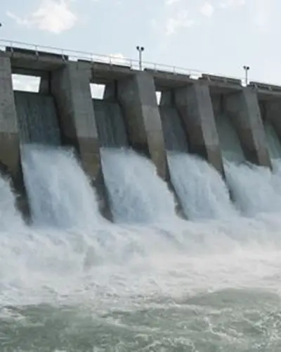
Advanced Hydraulic Modeling for Dam Safety and Flood Risk
RTI provides advanced hydraulic modeling and Emergency Action Plan (EAP) mapping to support dam safety programs, flood risk assessments, and emergency preparedness. RTI engineers simulate flood routing and inundation using detailed hydraulic models to understand how water moves through river systems and downstream communities during extreme flood and dam failure scenarios.
Using HEC-RAS to Simulate Flood and Dam Failure Scenarios
Using industry-standard tools such as HEC-RAS, RTI develops one- and two-dimensional hydraulic models that represent channel geometry, floodplains, hydraulic structures, and reservoir operations. These models are used to simulate dam breach scenarios, spillway releases, and extreme flood events to estimate flood depths, velocities, arrival times, and the spatial extent of inundation downstream of dams.
EAP Mapping to Support Emergency Planning and Response
The resulting hydraulic simulations provide the foundation for Emergency Action Plan (EAP) inundation mapping, which is critical for communicating flood hazards and supporting emergency response planning. RTI engineers develop detailed inundation maps, flood arrival timing estimates, and critical infrastructure impact assessments that help dam owners, emergency managers, and local communities prepare for potential emergencies.
Hydraulic Modeling and EAP Mapping Services Include:
- Dam breach and extreme flood inundation analysis
- Development of Emergency Action Plan (EAP) inundation maps
- Estimation of flood arrival times and warning zones
- Identification of impacted infrastructure and population exposure
- Coordination with dam owners, regulators, and emergency managers
Learn More About Our Solutions
Related Solutions


Meet the Experts
View All Experts
Navigate to
Bryan Luukinen

Bryan Luukinen
Navigate to
Ciara Pickering

Ciara Pickering
Navigate to
Ryan Johnson

Ryan Johnson
Navigate to
Michael Crouch

Michael Crouch
Navigate to
Shaun Carney