Solutions
Advancements in Geospatial Tech - Developing geospatial databases and applications to support research in public health, social policy, and the environment
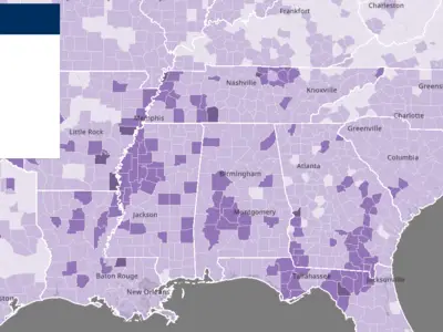
Geospatial analytics enables the creation of high-value geospatial data and research insights by overlaying, merging, and correlating the spatial relationships between disparate data sources whose only link is location. Our Geospatial technologies team develops geospatial databases and application programs to support geospatial analytics in both desktop and web environments and across a range of research domains, including public health, social policy, and the environment. We support multiple geographical scales—providing local, regional, national, and global geospatial processing data services. Our geospatial tech services use both satellite data and vast stores of vector data layers for information such as population, transportation, hydrography, environment, and socio-demographics. Contact us to learn how our advancements in geospatial technologies can help your organization.
![]()
![]()
Meet the Experts
View All Experts
Navigate to
Nicholas Kruskamp

Nicholas Kruskamp
Navigate to
Kelli DePriest

Kelli DePriest
Navigate to
Kellie Jones

Kellie Jones
Navigate to
Justine Allpress

Justine Allpress
Navigate to
James Rineer

James Rineer
Related Projects
Modernizing Food Safety through Immersive Video Training
Creating 360-degree video to teach farmers, processors, and food handlers around the world to protect consumer health
Read More about Modernizing Food Safety through Immersive Video Training