Products
Product Overview
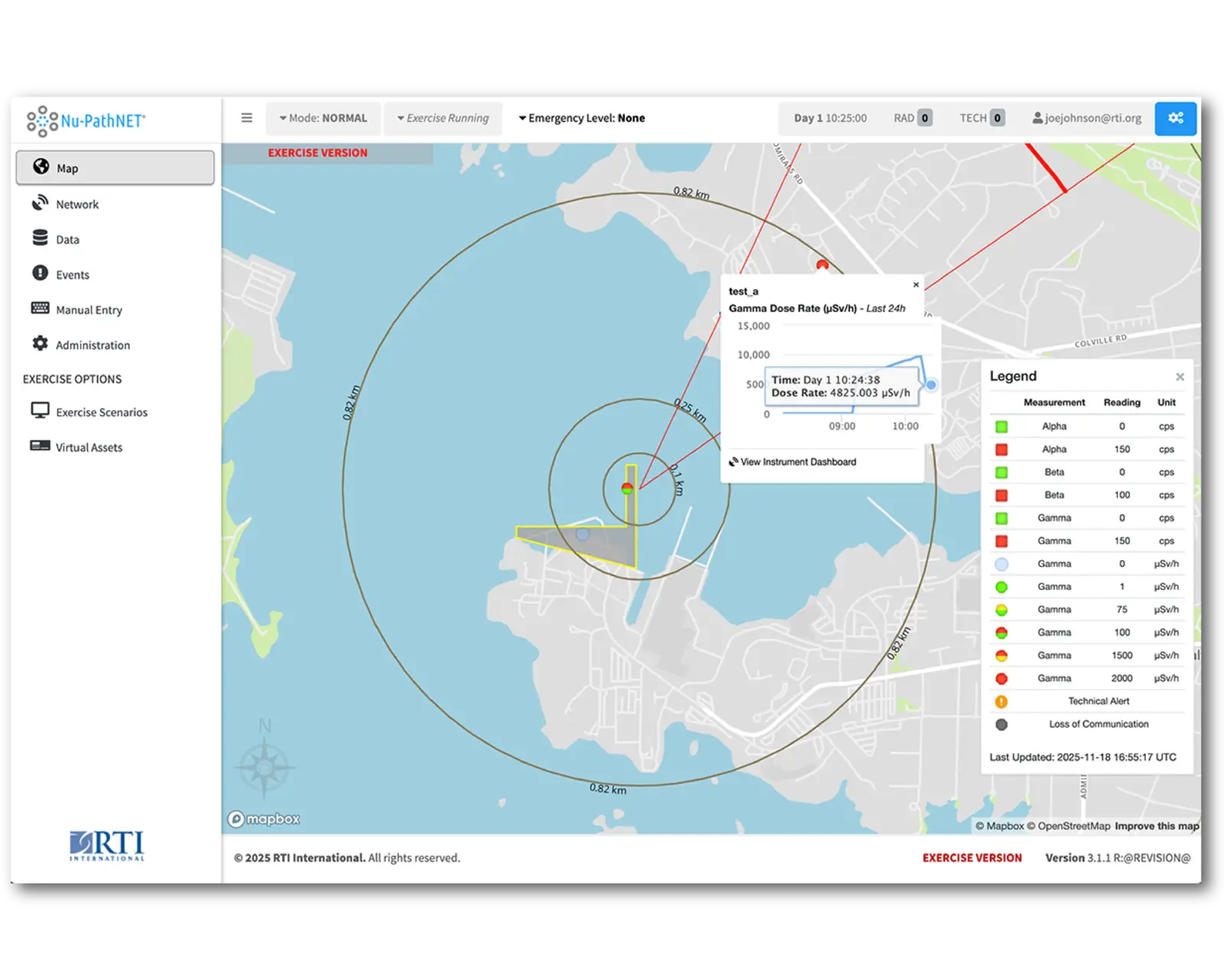
Nu-PathNET® is a web-based software platform that helps nuclear operators and emergency response organizations assess off-site radiological conditions in real time. Developed from RTI’s post-Fukushima radiological assessment work and years of support to nuclear facilities in the United States, Canada, and Europe, Nu-PathNET brings critical radiological, meteorological, and operational data into one environment to support faster analysis, stronger situational awareness, and more confident decision-making.
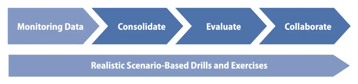
The platform is designed for the realities of emergency response: rapidly changing conditions, multiple stakeholders, and no time for fragmented data or manual workarounds. Nu-PathNET helps teams consolidate information, evaluate conditions, and collaborate across utility, local, provincial/state, and federal response organizations. At Bruce Power, RTI helped modernize off-site monitoring capabilities and transition to Nu-PathNET; Bruce Power’s use of the system received International Atomic Energy Agency Good Practice recognition.
Why Use This Product
Nu-PathNET is built to improve speed, clarity, and coordination in radiological emergency preparedness and response.
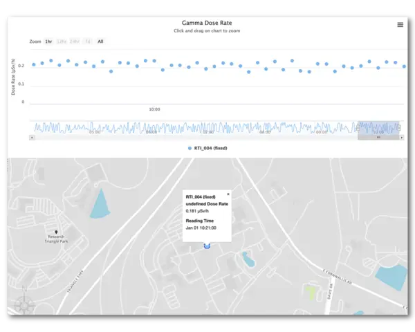
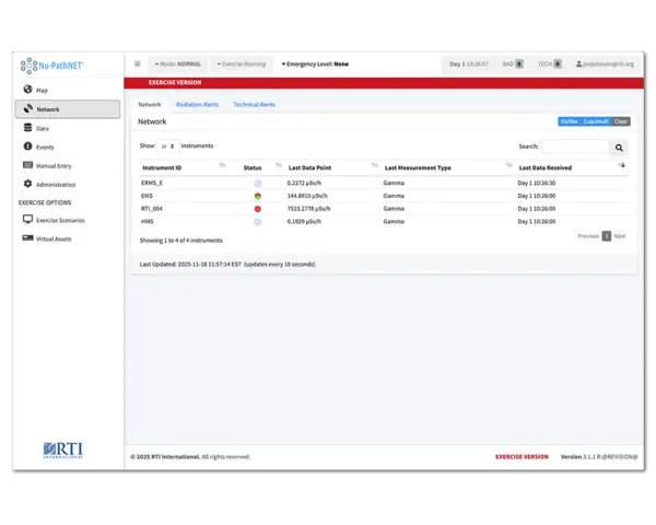
- See conditions as they develop. Collect and display dose rate, deposition, air concentration, spectral analysis, and supporting meteorological data in real time so analysts and responders are working from current information, not delayed field summaries.
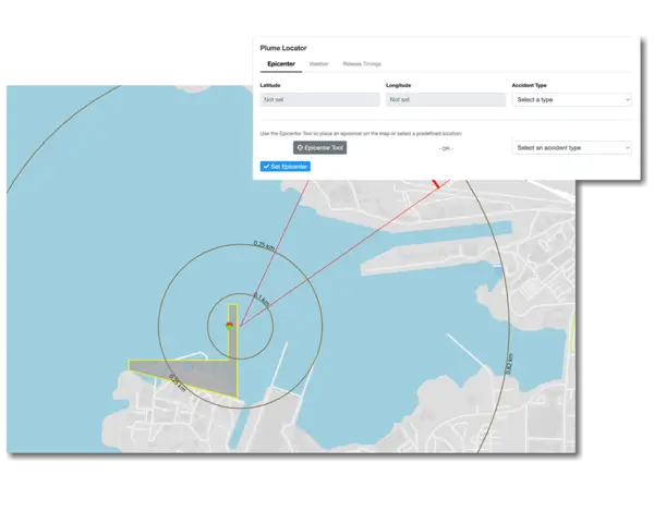
- Make better decisions, faster. Use customizable geospatial displays, time-series visualizations, tabular analysis, plume-location tools, dose-model overlays, and response-zone status views to understand what is happening and what action is needed.
- Reduce manual burden and improve safety. Automated monitoring lowers dependence on manual field survey processes, helps reduce responder radiation exposure, and minimizes reporting errors during actual events or exercises.
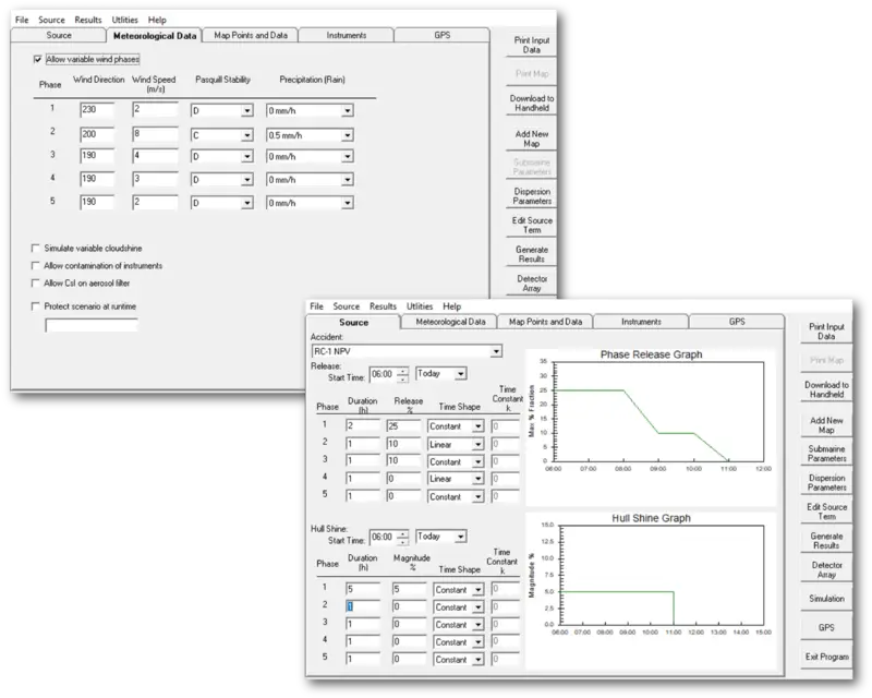
- Strengthen readiness through realistic training. Exercise mode and companion tools support simulated data, tabletop drills, and full-scale exercises so teams can train in conditions that closely mirror real response operations.
- Deploy with confidence. Nu-PathNET is deployed as a secure, highly‑available platform built for mission‑critical readiness. With industry standard multi‑factor authentication, seamless single sign‑on, and role‑based authorization, your teams get fast, trusted access while your data stays fully protected.
The Problem We Solved
For many nuclear emergency response programs, off-site radiological monitoring has historically been too manual, too slow, and too fragmented. Organizations often depended on field teams to collect data, separate laboratory workflows to interpret samples, and disconnected systems to assemble a picture of conditions. Changing weather variables added more uncertainty, making it harder to assess conditions quickly and direct protective actions with confidence.
Nu-PathNET was built to solve that problem. It consolidates sensor data, meteorological inputs, dose-model output, field measurements, and laboratory analysis into a single analytical framework where users can visualize, interpret, share, and act on information in near real time. That means faster assessment, more targeted field deployment, more consistent reporting, and a common operating picture across stakeholders.
The result is a more effective emergency response program: one that can move from spot-checking and delayed interpretation toward continuous monitoring, focused deployment, and collaborative protective-action decision-making. Bruce Power’s experience shows what that looks like in practice, with automated monitoring, streamlined response processes, and long-term operational reliance on the platform.

Who It's Built For
Nu-PathNET is designed for organizations responsible for radiological preparedness, monitoring, and emergency response, including:
- Nuclear power plant operators and emergency management centers.
- Health physics, radiation protection, and technical assessment teams.
- Local, provincial/state, and federal response agencies coordinating protective actions.
- Field monitoring teams using fixed or mobile assets, dosimeters, air samplers, and related equipment.
- Organizations conducting tabletop drills, full-scale exercises, and readiness training.
Deployment and Compatibility
Nu-PathNET is a modern web-based application available as either a software-as-a-service offering or an on-premises solution. It is designed to integrate with radiological monitoring equipment regardless of manufacturer and can be configured to align with site-specific emergency procedures, field surveys, dose models, meteorological data, reporting workflows, and response zones.
The broader software suite extends capability across field operations and training environments:
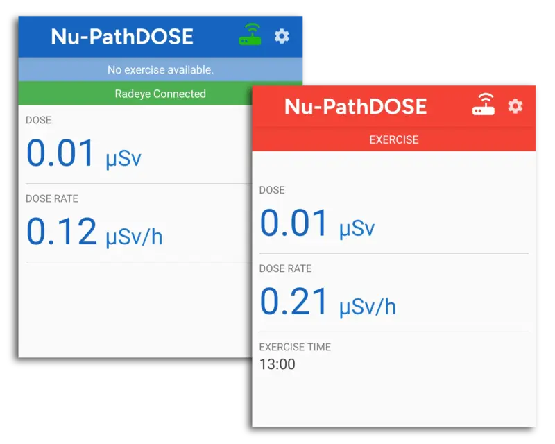
Nu-PathDOSE supports Android and Windows-based platforms and connects to radiological monitoring equipment through USB or Bluetooth, pairing readings with time and GPS location data for transmission to Nu-PathNET.
Nu-PathEXERCISE supports Windows-based platforms and enables realistic scenario creation for drills and exercises, from tabletop training to full-scale events.
Related Projects
Ensuring Readiness: Enhancing Nuclear Power Plant Emergency Response Capabilities
Read More about Ensuring Readiness: Enhancing Nuclear Power Plant Emergency Response Capabilities