An innovative and cost-effective method for selecting survey participants that produces accurate, probability-based results
In 2014, we were charged with conducting national-level household surveys in 12 developing countries to study barriers to internet access and usage. A quick, cost-effective, and reliable method for conducting these surveys did not exist at the time, so we pursued a way to do so that resulted in accurate and complete results with minimal training requirements for field staff.
Random walks—in which the households that a surveyor visits are determined by following an established set of guidelines—are inexpensive, but the results are often biased toward households that are easy for field staff to access and harder to track for quality assurance. Counting and listing is another sampling method, but it costs more, requires additional field visits, and is time-consuming.
Geosampling Represents a Comprehensive New Approach to Representative Surveying
With decades of survey experience and a diverse team of experts, we pooled our resources and developed geosampling—a fast, affordable, and high-quality solution that addresses the limitations of existing survey approaches. Geosampling incorporates various tools to provide field staff with a means of selecting representative households for computer-assisted, personal interview–based surveys.
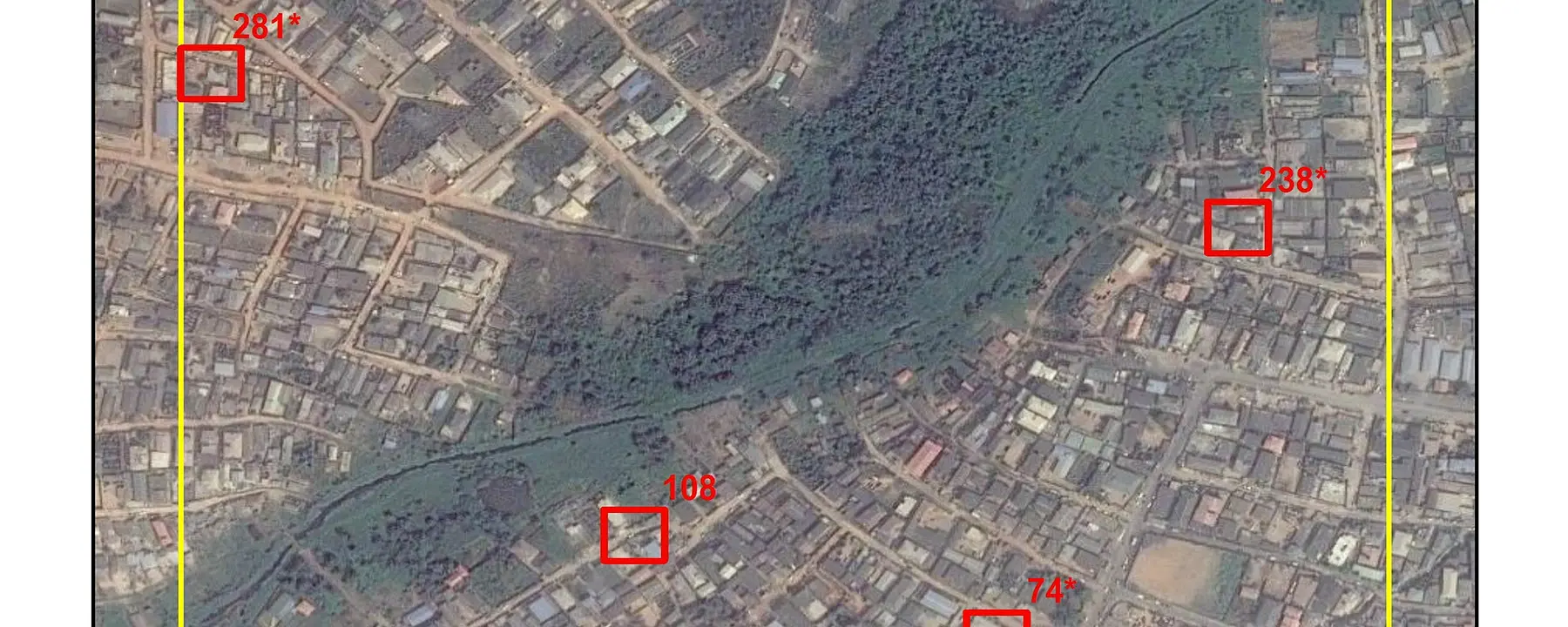
The first step in geosampling is to pick small areas, such as districts or municipalities, within a region that vary in terms of population, income, and infrastructure. Once these areas are identified, LandScan™—a 1-km-square dataset that models global populations from census counts, geospatial data, and other information—is used to identify areas within those districts or municipalities where homes are present and divide them into smaller sampled blocks. From there, further subselecting is completed, and a series of maps is developed that provide a complete, aerial view of the areas.
The maps are then uploaded to a tablet with global positioning system (GPS) capabilities to ensure that field staff are canvassing only homes in the specified area and help them determine the best route to those homes. The GPS capability does not require internet access, which is ideal for areas that do not have widespread internet coverage. In addition, the tablets promote quality assurance by allowing a third party to remotely track field staff, ensuring that the correct households are surveyed.
Exploring an Innovative Approach for Digital Listing
We are currently applying what we have learned from geosampling to the listing exercise. This time- and resource-intensive process remains prone to human error, including main street bias, in which enumerators miss buildings on alleys and side streets.
In an attempt to improve the standard listing exercise, our research team is investigating machine-learning models for classifying targeted grid cells selected in the geosampling process into residential versus non-residential areas. We are also using aerial and drone imagery for detecting and counting buildings. Research and field logistics have shown that the ideal strategy is to start the listing exercise with data extraction from aerial or drone imagery first in targeted grid cells, followed by field work to complement and validate the data extraction. Drone imagery provides better results than aerial imagery, but both provide an advantage over traditional field-based listing.
Applying Geosampling in a Host of Applications across the Globe
Geosampling is transferable, adaptable, and scalable, and can be used anywhere in the world. We have used geosampling to implement field surveys in Bangladesh, Brazil, Colombia, Ghana, Guatemala, India, Kenya, Nigeria, Rwanda, Thailand, and Uganda.
In addition to studying barriers to internet access, we have used geosampling to explore early childhood and maternal nutrition in developing countries for Alive & Thrive, an initiative to save lives, prevent illness, and ensure healthy growth and development through improved breastfeeding and complementary feeding practices.
- Various


